

Add Us On GoogleAdd as a preferred source on Google
Tenn. (WSMV) – First Alert Weather Days have been issued today through Tuesday for dangerous heat and humidity, along with some strong pop-up thunderstorms possible
Some patchy fog to start this morning. Other areas will see some scattered rain showers that should fizzle out by mid-morning
Later this afternoon, it will get very hot and humid. Highs will be in the low 90s but it will feel more like the 100s outside with the high humidity
More rain showers will develop late tonight with some storms possible overnight into early Monday morning. Heavy rain and gusty winds are the main threats
For life-saving weather alerts, customized messages on conditions and forecasts, and videos detailing upcoming weather events, download the WSMV 4 First Alert Weather app foriPhoneorAndroid. Have weather pictures or videos? Share themhere
FIRST ALERT WEATHER DAYS– TODAY THROUGH TUESDAY
First Alert Weather Days have been issued for today through Tuesday. Stifling levels of heat and oppressive humidity will return to the Midstate then, sending the heat index higher than 100 degrees. Be sure to stay hydrated and take plenty of breaks in the shade or inside with the A/C
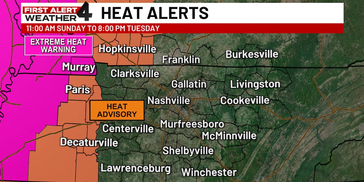
Heat alerts have already been issued for a few areas of Middle Tennessee. An Extreme Heat Warning is in effect for west Tennessee and a Heat Advisory has been issued for western Middle Tennessee. Theses both last until 8 p.m. Tuesday
TODAY’S FORECAST
- Morning– Patchy fog and some scattered rain. Temps in the low 70s.
- Afternoon– Turning very hot and humid. Highs in the low 90s but it will feel like the 100s.
- Evening– More scattered rain and some isolated storms possible.
MONDAY’S FORECAST
- Morning– Patchy fog in some areas. Temperatures starting out in the low 70s.
- Afternoon– Extreme heat and humidity. Feels-like temperatures will reach 110º or higher in some areas. A few pop-up storms will be possible.
- Evening– Lows fall to the mid 70s.

REST OF THE WEEK
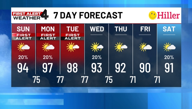
Tuesday will continue to be extremely hot and humid. Heat index values will be around 110º again. Once again, a few scattered showers and storms will be possible
We finally start to cool down by the middle of the week. Wednesday will be cooler with a high around 90º and slightly lower humidity. Lows fall into the upper 60s by Thursday morning
Thursday and Friday will be nice in the upper 80s with a mix of sun and clouds. Lows in the mid to upper 60s
Showers and storms return again by the weekend
